
Sumter Neighbor Research Sources
For a block question, the official sources are best read as separate layers. The City and County mapping tools establish geographic context. The County property route can provide a property-card lead if its live service allows the lookup. The Register of Deeds holds recorded instruments. Election records have a limited statutory inspection path, but no verified online source produces a neighborhood or block list. The table makes those boundaries clear before a researcher combines unrelated facts.
| Source | What It Shows About a Block | Access |
|---|---|---|
| City/County parcel-address map | Mapped parcels, roads, addresses, subdivisions, and City-limit context | Public map viewer; confirm layer date and visible identifiers. |
| County property route | A parcel or property-card lead for a verified address or parcel | County-designated gateway; active fields and coverage require live confirmation. |
| Register of Deeds | Recorded instruments, parties, dates, and legal-description references tied to land research | County-linked index gateway; ask the office about access, images, and coverage. |
| County Voter Registration & Elections | A statutory inspection route for voter-registration records, subject to custodian rules | County office; not a public street, block, or household list. |
| Crosswell Neighborhood Association reference | A dated City recognition of that association name | Historic City reference only; no roster, boundary, officers, or current directory was verified. |
These records cannot be compressed into a profile of Sumter neighbors. A parcel may touch another parcel without establishing a personal relationship. A recorded party may be historical. A property mailing address may differ from the physical site. Use each item as the kind of evidence it is.
Map a Sumter Block Carefully
The adjacent-parcel method starts with a single address and stays focused on mapped geography. It does not turn a map into a household list. A consistent note for each result includes the map date, subject parcel identifier, City-limit observation, any plat or deed citation, and the office contact for a question that needs confirmation.
- Open the City Mapping Services route and find the address in the City and County parcel-address viewer.
- Set a useful scale, record the viewer date, and identify the subject parcel or displayed location identifier if one appears.
- Note the parcel identifiers that touch the subject geometry. Describe them as adjacent mapped parcels, not as people or households.
- Check each parcel separately through the County property route, keeping the physical address, mailing address, and parcel identifier distinct.
- For a land-history question, follow each separate instrument reference through the Register of Deeds rather than assuming a shared name or mailing pattern links parcels.
The flow is address → map context → subject parcel → touching parcel identifiers → separate County and recorded-document checks. For a whole named street rather than an immediate block, the Sumter street directory gives the fuller street-by-street method.
Note: Screenshots of map geometry are useful research notes, but they are not surveys or final evidence of a boundary, title, or City jurisdiction.
Sumter Maps Do Not List Neighbors
City Mapping Services identifies parcel, road and address, zoning, flood-hazard, census, cemetery, and elected-representative maps. Those layers make it easier to distinguish a road, parcel, City boundary, or mapped feature. They do not establish current residence, household membership, family ties, a delivery recipient, or a block roster. The proper label for a map finding is an adjacent mapped parcel.
Start with the City-limit layer if the question is municipal jurisdiction. Use the County property route for an assessment-related lead. Use the Register of Deeds for a recorded instrument. A flood, zoning, or cemetery layer serves a different purpose and should not be treated as a title source. This source-by-source approach is especially useful around a City boundary, where individual annexation actions can affect one parcel without defining the status of another.
City Council has published annexation actions at 1280 Alice Drive in 2019 and 2600 Broad Street in 2017. They are methodological examples, not proof about any other address. Planning can identify the applicable boundary record when the GIS view needs an official confirmation.
Sumter Neighborhood Association Evidence
Officially visible association evidence is narrow. A City Council highlights page from March 2018 refers to the Crosswell Neighborhood Association in a recognition context. It is evidence that the City used that name on that date. It is not evidence of membership, a boundary map, current officers, a public website, or a City-maintained directory of all neighborhood groups.
The City recognition notice is the source for the limited Crosswell reference retained here.
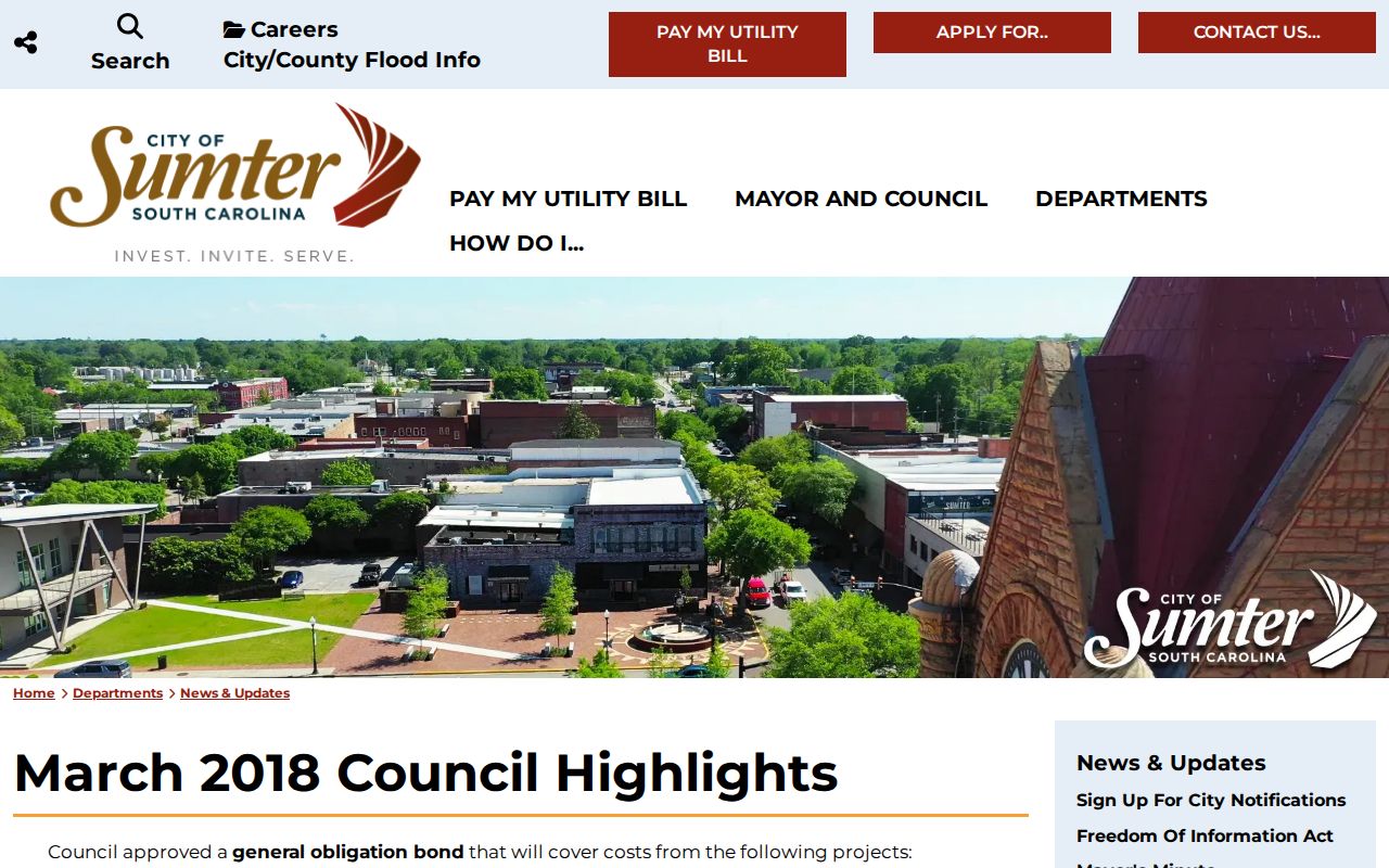
The captured City page supports a dated organizational reference, not a list of Sumter neighbors or a current association roster.
Crosswell Neighborhood Association
Source: City Council highlights, March 2018.
What is documented: The City used the association name in a recognition context.
What remains unverified: Current contact, boundaries, officers, website, and membership.
Current civic-area question
Best contact: City Planning or City Clerk through the City of Sumter.
Ask for current public civic or area information and retain the source date. Do not infer an association from a subdivision label on GIS.
No official Citywide association directory, boundary inventory, or contact roster was found in the research. That is a useful limit, not a reason to invent one from parcels or subdivision names.
Sumter Neighbor Voter Records Limits
South Carolina Code §7-5-410 provides a route for a citizen to inspect voter-registration records at the County board or Clerk’s office. That rule does not create a general web directory of voters by street, block, household, or ZIP Code. The application may contain personal fields, and redactions, copying rules, and identity safeguards remain matters for the custodian.
For an individual’s own registration details, polling place, sample ballot, or voting-history task, use MySCVotes. The live interface was not inspectable enough to describe its fields, and it must not be presented as a neighborhood search. Ballots are secret, so a voting-history pathway does not disclose choices for candidates or measures.
A narrow, lawful administrative request belongs with Sumter County Voter Registration & Elections, not a bulk effort to reconstruct a block. The County office can explain current viewing, copy, redaction, and fee procedures.
Recorded Land Around Sumter Blocks
The Sumter County Register of Deeds gateway is the documentary route when a parcel research trail points to a deed, plat, easement, release, mortgage, power of attorney, or another recorded instrument. The live index and its coverage were not reproducibly available during research, so its active search fields, image availability, account rules, and fees must be confirmed before use.
The Register of Deeds index entry route is shown below as the documented County-linked access point.
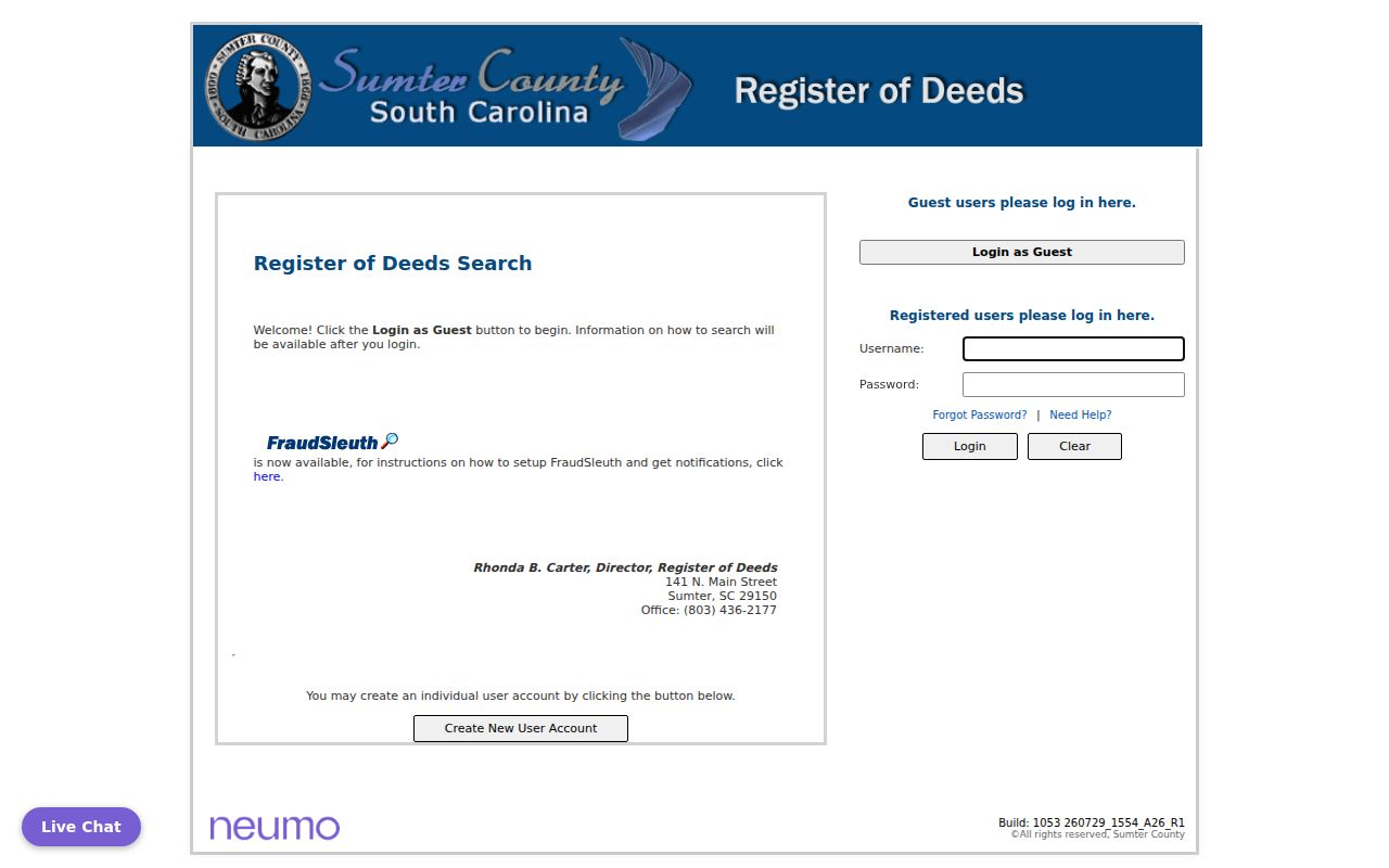
The access screen is a reminder to check its current account and index conditions with the Register of Deeds before planning a document search.
When an instrument reference is available, preserve the instrument type, recording date, book and page or instrument number, grantor and grantee names as printed, legal description, and citations to prior documents. A recorded party is evidence of that document, not proof of present title, present residence, or a relationship to an adjacent parcel. The office is at 141 N. Main St., Sumter, SC 29150, and the courthouse listing gives 803-436-2177 for its contact route.
Note: If the property route and recorded document appear to differ, preserve both items and ask the responsible office rather than selecting the field that seems newer.
Compare Sumter Neighbor Source Types
Official maps and custodial records are designed for specific public functions. Commercial neighbor tools are a separate category and can combine stale, incomplete, or mismatched data. Neither category authorizes a claim about a household. For a family-history, estate, or property-context question, the strongest practice is to record the official source, the date, and the limited fact it actually supports.
| Source type | Useful for | Do not treat it as |
|---|---|---|
| Official GIS and parcel layers | Parcel geometry, roads, City-limit context, and mapped features | A current household list, survey, or title opinion |
| County property and recorded-document routes | Administrative property leads and dated instrument research | Proof that someone currently lives there or owns every interest |
| Commercial neighbor tools | A possible prompt to verify an official source | A complete, current, or authoritative account of people around an address |
When an official source is inaccessible, state that access condition and contact the custodian. Do not replace a missing map layer, public portal field, or association roster with an inferred result.
Historic Sumter Neighbor Questions
A historic block asks different questions from a current one. The 1905–06 Walsh directory has a street department with house number, occupant, and use. The 1902 Sanborn set contains nine sheets that can show street layout, building footprints, and historical use. Neither source establishes current occupants, legal boundaries, or a modern mailing address.
Sumter’s documented growth began around Main Street, moved toward Calhoun, Hampton, North Main, and the railroad, and later included mid-century subdivision plats. Compare a dated directory or map with the relevant plat and recorded-document chain rather than assuming that the same number retained the same physical meaning. No authoritative Citywide street-renumbering or conversion rule was found.
The Sumter Museum archive route accepts historical research questions through its appointment and genealogy referral path. A useful request includes name variants, date range, the street or address as written, a directory or map page already checked, and a specific question about a plat, photograph, manuscript, or military collection.
Respect Privacy Around Sumter Neighbors
Public availability does not mean unrestricted republication. Vital records have statutory access limits, court materials can be confidential or sealed, and protected records must remain protected. The South Carolina Attorney General’s Address Confidentiality Program offers eligible participants a substitute mailing address and mail forwarding; it does not erase prior records or create a general address database.
If a government record seems wrong, contact the office that owns it: mapping staff for a parcel or address display, the Register of Deeds for a recorded instrument, the Clerk for a court filing, or the County election office for a registration matter. Respect a visible redaction as an access boundary rather than attempting to reconstruct it from other sources.