
Sumter City Directory Holdings
The documented online starting point is Walsh's Directory of the City and County of Sumter, S.C., a 1905-06 volume published by Walsh Directory Company. It separates a general name directory, a street department, a classified section, and a county, taxpayer, and post-office section. That structure gives a researcher more than one route through the same edition. It does not establish that the Library, Museum, or any online collection holds a complete sequence of later Sumter city directories.
| Collection | Years | Where held | Access |
|---|---|---|---|
| Walsh's City and County directory | 1905-06 | University of South Carolina Digital Collections | Free online volume |
| Sumter Museum Archives | 1740-present scope statement | Sumter Museum | Appointment inquiry |
| Sanborn fire-insurance maps | 1902 | Library of Congress digital set | Free online, nine sheets |
| Historical archive indexes | Varies by series | South Carolina Department of Archives and History | Catalogue and index research |
The table is an evidence map, not a claim of a continuous directory run. Ask the Sumter County Library, Museum, or Genealogical Society about another edition by title, year, publisher, and surname. That lets staff check a shelf, microfilm, vertical file, or catalogue record without guessing which volume is meant.
Walsh's Sumter City Directory
The 1905-06 Walsh volume is the clearest verified Sumter city directory collection. A name listing may join a person to a residence and occupation for that edition. The street department reverses the question: it organizes a house number with an occupant or use. The classified pages and county or post-office material can add a business-category or mailing clue. Each part must be read as dated published evidence. A residence line does not prove title, a family relationship, or a person’s current location.
View the digitized Walsh directory before transcribing a result. Capture the image or page number, the volume title, and the spelling as printed. Initials, abbreviations, and street forms are often the details that make a later map or deed search possible. A name that appears only once still needs a second, independently dated source before it supports a family-history conclusion.
The source image below is from the University of South Carolina Digital Collections directory record.
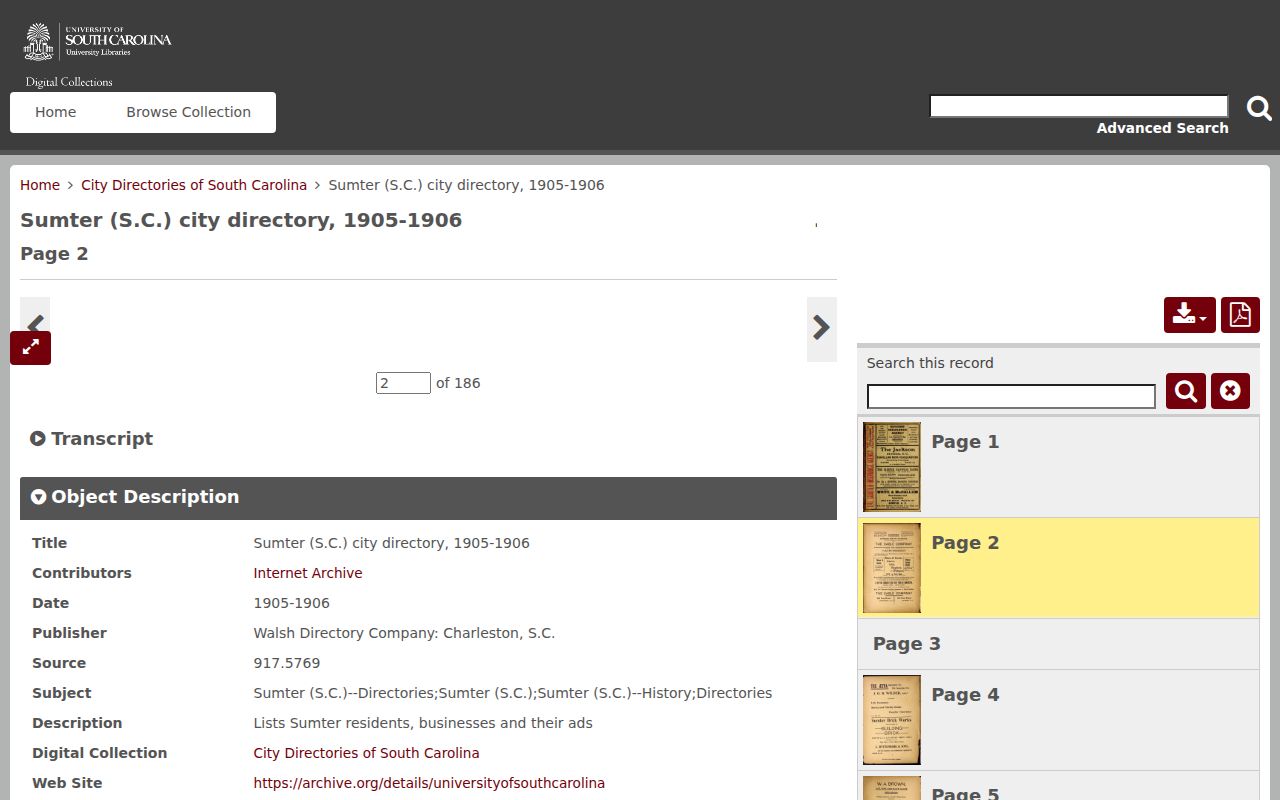
The displayed title and browsing screen confirm the edition to cite, while the directory pages themselves supply the historical entries.
Sumter Archive Records
For an edition that is not online, use the Sumter County Library reference route for research assistance and online-database help. The Library is at 111 N. Harvin Street and lists 803-773-7273. Research did not locate an official online inventory that lists every local directory year or publisher, so the responsible wording is a collection question, not a promise that a particular volume is available.
The Sumter Museum adds a different historical layer. Its archival collections include manuscripts, plats, photographs, and books, and archival research is by appointment. The Museum directs genealogy questions to the Sumter County Genealogical Society, which meets by appointment in the lower floor of the Williams-Brice House. Give the staff a name variant, date range, address as printed, and the Walsh or map page already checked.
The source image below links to the Library’s documented reference-assistance route, not to a claimed online directory catalogue.
Use the Library contact to ask whether a particular Sumter city directory, map, or local-history source can be consulted or referred to another custodian.
The Sumter Museum archive route documents the appointment and genealogy-referral path for collection questions.

The Museum source complements the Library route when a directory clue needs plats, manuscripts, photographs, or other historical context.
Reading Sumter City Directory Entries
A city directory entry is compact, so the page beside it matters. The general portion of the Walsh volume can associate a name with a residence and occupation. The street department can associate a number with an occupant or use. Read the abbreviations used by that exact volume before expanding any short form. Later editions, if located, can use different marks and layouts.
| Name | Use the spelling and initials exactly as printed. |
|---|---|
| Residence | A dated address lead, not proof of modern residence or ownership. |
| Occupation | A period description that may help distinguish people with similar names. |
| Street department | An address-ordered route that can show occupant or use for the edition. |
| County or post-office section | A separate historical clue, not a substitute for a current address record. |
- Householder index
- A name-ordered listing used to locate the residence line printed in a directory.
- Criss-cross directory
- An address-ordered directory format. No verified Sumter criss-cross run was located, so ask the Library or Museum about a specific year.
- Abbreviation key
- The page in a volume that defines its own shortened terms. Preserve it with any transcription.
Note: A printed listing supports only what that edition says for its publication period and should be paired with another dated source before drawing a historical conclusion.
Sumter Historic Street Records
Use the Walsh street department alongside the 1902 Library of Congress Sanborn map set. The nine sheets can show a block’s built environment, street layout, and historical use context. The historic survey describes early Sumter development around Main Street, growth toward Calhoun, Hampton, and North Main, and later expansion toward the railroad. Those patterns explain why an old address needs a date and a map edition.
A current map does not automatically translate a 1905 address. Research found no authoritative Citywide street-renaming, renumbering, or address-grid rule for Sumter. Keep the original wording, compare the relevant dated map or directory, then look for a plat, recorded document, annexation record, or staff guidance that actually connects it to a later parcel.
For current geography, City Mapping Services identifies parcel, road, address, zoning, flood-hazard, cemetery, census, and City-limit map products. The map provides orientation, not a conclusion about a historical household.
Trace Sumter Household Records
A sound household trail uses time as its control. Start with a confirmed page in a historical directory, copy its exact name and address, then compare sources from nearby years. The federal census can fill a wider household context, but many periods and records have gaps or access limits. The directory should be treated as one dated lead, not a verdict about a family’s movement, ownership, or identity.
- Locate the name in the 1905-06 Walsh volume and preserve the page or image citation.
- Check the street department for the address form and listed occupant or use.
- Compare the same period with a Sanborn sheet, a plat reference, or a record identified through SCDAH online research.
- Pair the dated directory evidence with the appropriate census or historical index, keeping the source dates visible.
- Ask the Library, Museum, or Genealogical Society about manuscripts, photographs, plats, or another directory edition.
When a name disappears, several explanations remain possible: a move, a death, a changed spelling, a publication choice, or a missing volume. The South Carolina DPH death-records route and the documented 1915-1967 historic death-index material can help narrow an event, but the index is a lead rather than a full certificate.
Sumter Museum Archive Records
The Museum Archives are especially useful when a directory line raises a question a directory cannot answer. SCDAH’s repository description places records of the old Sumter District, journals, correspondence, photographs, military materials, plats, and Sanborn maps within the Museum’s scope. The old district also included territory now associated with Clarendon, Lee, and Sumter counties. That historical jurisdiction matters for research that predates modern county boundaries.
Ask a focused question. Include name variants, a date range, the historical jurisdiction, a street or property as written, and the directory or map edition already searched. An archive can then check whether relevant manuscript, photograph, plat, or vertical-file holdings exist. It cannot be assumed to have every family or address indexed online.
Note: A Museum appointment is the documented route for archival questions, while collection availability and exhibit access should be checked on the current Museum page.
Sumter Historical Record Timeline
Place a directory or map beside the event it can actually date. Sumter’s civic history has several valid dates because they describe different events, not one interchangeable founding claim. The historical-property material identifies Sumterville’s incorporation in 1845, its later rename to Sumter, and its charter in 1871. Those milestones give historical directory research a civic frame, but they do not convert an address from one period into another.
- 1845: Sumterville was incorporated, according to the cited historic-property material.
- 1871: The place was renamed Sumter and chartered.
- 1902: The Library of Congress Sanborn map set records streets, structures, and uses on nine sheets.
- 1905-06: Walsh Directory Company published the verified city and county directory volume.
- 1949-1959: Historic-survey material identifies dated subdivision plats including Bon Air Terrace, Burns Downs, Pinefield, Flowers Heights, Wen-Le, Edgewater, Folsom, and Audubon Park.
Use the date beside the source, not as a shortcut. A 1902 map, a 1905-06 Walsh volume, and a mid-century plat each describe their own record moment. A particular parcel still needs a source that carefully connects the historical wording to later land evidence.
Sumter Record Dates and Gaps
Sumter’s historical record landscape has useful, but uneven, evidence. The digitized Walsh directory is an exact 1905-06 edition. The 1902 Sanborn maps are another dated artifact. Museum materials have a broad 1740-present repository scope, while SCDAH index coverage changes by record series. None of those facts proves a complete chain from one year to the next.
Record the repository, title, publisher or creator, edition date, page or image number, and access link for every useful finding. Keep uncertain initials and street abbreviations as printed. For an older land question, the Sumter County Register of Deeds gateway is the official route for recorded instruments, though its live fields, coverage, image access, and fees need confirmation from the office or active portal.